Fearless’ Folly – El Mirage 4×4 Trail created by The RoughWheelers IV Club
Way, way, back, there was a fearless wagonmaster who would speak of an unknown shortcut between the towns of El Mirage and Adelanto through the rugged hills to the north. Most of those overhearing his claim dismissed it as the addled mutterings of a man consumed with too much distilled mescal.
One day, a shipment of ice arrived in Adelanto, and it needed to be moved to El Mirage as quickly as possible. A teamster who had overheard the story the night before in the tavern quickly raised the hung-over wagonmaster, and cajoled him into leading them over this shortcut. The agreed payment was a number of bottles of choice mescal, paid in advance.
They departed immediately, heading for the hills. Hither and yon they traveled, stopping now and then to repair broken axles, yokes, and wheels. At every junction, the fearless wagonmaster confidently pointed the way. Up rocky gulches, down steep hilsides, through clutching thorny flora in the desert heat they went.
Two days later, they arrived at the town of El Mirage, bruised, scratched, battered wagons full of wet canvas and empty mescal bottles, the precious ice long melted.
The secret shortcut was never mentioned again. The route was believed lost to history.
Until now…
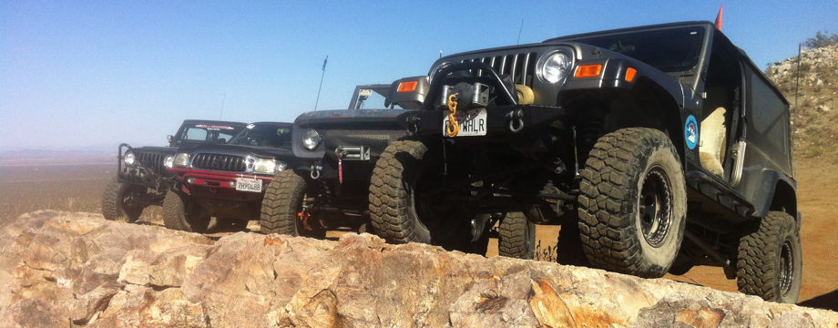
Welcome to El Mirage Off-highway Vehicle Area’s new 4×4 trail.
This challenging 4×4 trail runs over steep hills and through narrow gulches with loose and sharp, rocky terrain adding to the challenge. This is the desert at it’s finest. Do not attempt this trail alone.
Vehicle damage, including rollover, is possible. Tire damage is common. High clearance 4×4 and a full-sized spare tire are a must. Lockers are recommended.
Respect closed area signs. No glass containers are allowed in the El Mirage OHV Area. Wood for fires must be free of nails and screws. Always leave the area cleaner than you found it by picking up trash.
The Trail
Fearless’ Folly Trail Map

Trail Description
The trail begins at the wide junction of trails about 6.3 miles in on Mountain View Road.
From the starting point, follow the track northeast about 0.4 miles to the tracks going up the hill on the left at FF010.
Go up the hill toward FF011, and follow the tracks down and across the valley toward FF013.
At FF013, the track going up the hill to the left is loose and steep with a deep rut near the top which can pitch a vehicle onto it’s side. The track on the right is an easier path. Both tracks rejoin at FF014.
At FF015, the track to the left is a narrow and rocky gulch. The steep track to the right is easier, but not by much. Both tracks rejoin at FF016. Return down the hill via the trail you did not take! Hint – going up the hill and coming down the gully is more fun and challenging.
Upon reaching the main East Loop trail again, turn right and follow it about 0.3 miles to FF020. Turn right and go about 0.1 miles to FF019. Turn right and follow the track down a challenging run weaving through a gully. There are a couple boulders to squeeze between, or drive over if you have the clearance. This track will reach the main East Loop trail again, and turning right will return you to FF020. FF021 marks the ascent of a moderate rocky hill. As you descend to FF022, there is a wide pull-out for watching those challenging Snoopy’s Gulch.
FF022 to FF022a is a most difficult climb up a steep, narrow, rocky gulch. The final climb is quite loose. At the top, there is room for a number of vehicles to stop. This is a spur, so the exit is back along the way you entered. Body damage is likely.
From FF022, follow the track south. The track is smoother here, and very popular for fast-moving ATVs and dirt bikes.
At FF023, you can follow the track east to FF024 and back to the start, or you can continue South to Resurrection Hill and the lake bed.
Enjoy, and be safe.
GPS Coordinates (WGS-84)
| Latitude | Longitude | Map Label |
| 34.692507 | -117.554891 | Start/End |
| 34.696400 | -117.549670 | FF010 |
| 34.696755 | -117.552561 | FF011 |
| 34.694250 | -117.554970 | FF012 |
| 34.693080 | -117.559120 | FF013 |
| 34.695520 | -117.560230 | FF014 |
| 34.697050 | -117.560900 | FF015 |
| 34.700750 | -117.560870 | FF016 |
| 34.698720 | -117.567000 | FF019 |
| 34.697220 | -117.566730 | FF020 |
| 34.697530 | -117.569730 | FF021 |
| 34.697474 | -117.573845 | FF022 |
| 34.699738 | -117.575411 | FF022a |
| 34.689600 | -117.579150 | FF023 |
| 34.689470 | -117.563330 | FF024 |
Directions to El Mirage from Palmdale Take the Pearblossom exit (Highway 138) from Highway 14 in Palmdale. Go East (toward Victorville/Hwy 18) on Palmdale Blvd. The road forks a couple miles outside of Palmdale, with Palmdale Blvd continuing straight, and Hwy 138 East veering right. Turn left to remain on Palmdale Blvd, going East for about 20-25 miles until it ends at 240th. Turn left onto 240th. Go North about 1 mile to El Mirage Blvd. Turn right onto El Mirage Road
Turn left on Mountain View Rd to El Mirage Recreation Area Go about 6.3 miles straight ahead. Just past Outhouse #10, there will be a wide junction of multiple trails. This is the starting point.
Directions to El Mirage from Victorville Take the D St/Hwy 18 exit from I-15 in Victorville. Turn onto D St/National Trails Hwy going Northwest. Go North about 2 miles to Air Expressway Blvd. Turn left onto Air Expressway Blvd. Go West about 4-1/2 miles to 395. Turn right onto 395, go about 1 mile North to Crippen Ave. Turn left onto Crippen, go about 3 miles West to Koala Rd. Turn right onto Koala, go about 1 mile North to El Mirage Rd. Turn left onto El Mirage, go West for about 5 miles to Mountain View Road. Right on Mountain View Rd to El Mirage Recreation Area Go about 6.3 miles straight ahead. Just past Outhouse #10, there will be a wide junction of multiple trails. This is the starting point.
Related Links:
- BLM’s El Mirage site: http://www.ca.blm.gov/barstow/mirage.html
- Friends of El Mirage site: http://www.elmirage.org/
- The Roughwheeler’s site: https://www.roughwheelers.com/